Technical Assessments
Transport
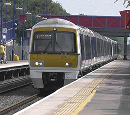
Vehicular access to the site is proposed from Drayton Road via a priority T-junction with a separate right turn lane for traffic travelling from the west. A shared footway/cycleway will connect with the existing Public Right of Way that runs along the site frontage to the north-east. This will connect with the existing shared footway/cycleway at the Drayton Road/ A4146/ Jersey Drive priority roundabout, with access to and from the rest of the existing PRoW network to be retained. The additional traffic the proposed development is predicted to generate is around 179 to 184 vehicular trips in the AM and PM peak hours. Junction capacity assessments, which consider the cumulative effects of other committed developments and infrastructure in the area, will be undertaken. The results will be reported in a Transport Assessment alongside an assessment of highway safety matters. Bus stops are located on Lansbury Road approximately 300 metres north of the centre of the site. There are also bus stops on St Helena Avenue, approximately 550 metres north of the centre of the site. Bletchley Railway Station can be reached by cycling or by bus. A Travel Plan will set out measures to promote and encourage the use of sustainable transport.
Drainage
According to the Environment Agency Flood Map for Planning, the application site is located entirely within Flood Zone 1 (Low Probability), which is land defined as having less than a 1 in 1000 annual probability of river or sea flooding.
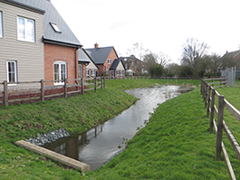
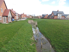
There are a small number of minor watercourses within the site boundary that ultimately link to the watercourse at the bottom of the site. These will be maintained and enhanced as part of the development and in line with local planning policy will retain a suitable buffer to ensure they are not impacted by the development.
The EA surface water flood mapping identifies an area of low to high risk of flooding around the southern boundary, however only the low-risk extents encroach onto the site. Low risk surface water flooding is also defined as having less than a 1 in 1000 annual probability. As part of the proposed development, levels across the site will be reprofiled to eliminate any ponding and ensure that surface water flows are directed away from plots and managed as part of the new infrastructure.
An appropriate Surface Water Management Strategy which complies with the latest local and national advice will be implemented on the site to attenuate the increase in surface water runoff caused by development. The proposed development will seek to outfall to the existing watercourse at the bottom of the site, mimicking existing conditions on site. The rate at which the runoff is discharged will be restricted to the equivalent greenfield runoff rate for events up to the 1 in 100 year event plus an allowance for climate change. This will not only prevent an increase in flows leaving the site but in more severe events provide a substantial reduction, thus ensuring that the proposed development does not have a detrimental impact upon flood risk elsewhere.
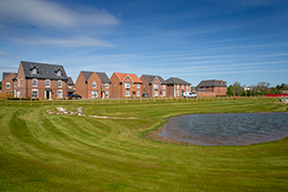
The drainage will be designed to provide amenity and biodiversity benefits, as well as water quantity and quality control.
Foul drainage will drain via gravity to a new pump station to be delivered as part of the development. It is proposed to pump to the existing Anglian Water foul sewer within Anglesey View to the north.
Anglian Water confirmed that the existing foul network has sufficient capacity for the development.
Utilities
Whilst utility assessments are still being carried out, Anglian Water have confirmed that a point of connection would be taken from the existing Water main located within Drayton Road. Initial modelling reports suggest that some upstream reinforcement works will be required, expected to be 570m of new potable Water mains along Jersey Drive & Galapagos Grove, to ensure existing supplies are not affected by the development proposals.
SGN have an existing high pressure Gas pipeline that runs through the centre of the proposed development site and the development layout has been designed to ensure that this pipeline can remain in-situ unaffected by the development proposals.
UK Power Networks have an existing overhead Electricity Network that runs across the proposed development site, it is currently proposed that this network will be replaced with a new network buried under ground.
With regards to new Electricity connections for the proposed development, these will be provided at High Voltage, expected to connect from the South of the proposed development site. The development site will have its own Transformers/Substations installed to provide low voltage Electricity supplies as required.
Openreach will provide full fibreoptic telecommunications services to the site, however, there are alternative telecommunications providers who can also provide telecommunications services to the proposed development, these can be explored further as the details of the proposed development site progress.
Other Assessments
Additional assessment work has been undertaken to inform the proposals for the site including a landscape assessment, ecology surveys, archaeology, and heritage work. The planning application when submitted to the Council will include all relevant reports and information.


